


If you like hiking, don't miss this ravine.

Barranco del Toro is an underrated and hidden place in the south of Gran Canaria. In the rainy season, the ravine becomes one of the best places for hiking in the south of the island, as it forms waterfalls and natural freshwater pools, from where you can jump into the pools from about 10 metres. Apart from hiking, it’s also suitable for abseiling, so let's discover it!
Where is the Barranco del Toro ravine located?
Barranco del Toro (or Charcas Verdes) is located in the south of the island, in San Agustín, in San Bartolomé de Tirajana. Here’s the exact location:
How to get to Barranco del Toro
By car: On the GC-1 towards the south of the island, take exit 43. After about 500 metres, you’ll reach the fork for GC-500 San Agustín and Playa del Inglés. Take the left towards San Agustín. At the roundabout, change direction and after 750 m you’ll find an exit on the right where you can park and leave your vehicle.
By bus: You can take any bus line, depending on where you are, that stops in San Agustín, such as the most popular 01 and 05 or the 30, which are good options both from the south of the island and from the north or the capital.
On foot, we arrive at Bonsai street. We pass the installations of Canaragua, the municipal water service, and after about 100 metres, on a bend to the left, we enter a path on the right through a wooded area.
What to do in the Barranco del Toro ravine
This ravine is spectacular to enjoy the views, take photos, swim in the water, see the small waterfalls, for climbing, hiking, abseiling, even as a circular route for mountain biking (Mtb).
Hiking route through the Barranco del Toro ravine
Are you up for the hiking route through the Barranco del Toro ravine? It’s an easy to moderate difficulty route, as in some sections you have to move between large rocks.
Distance: 5km
Technical difficulty: Moderate
Minimum altitude: 17m
Maximum altitude: 98m
Positive difference in altitude: 143m
Negative difference in altitude: 143m
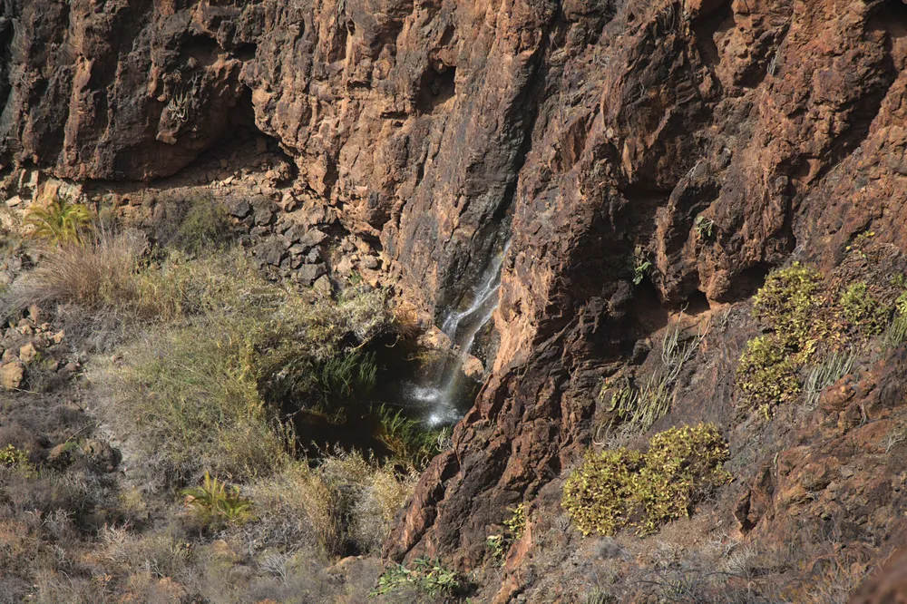
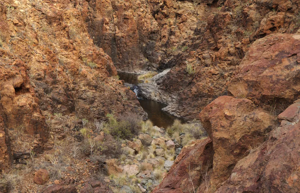
It’s a circular route that can be covered in two to three hours. We recommend going in winter, as it’s very dry in summer. Even better is after the rains, as you can see streams and small waterfalls in the Toro ravine. You can find several puddles and even natural pools at the end of the route several metres deep.
To get there, as we’ve already mentioned, we follow the left side of the football field fence and go down a staircase. We pass the tunnel under the motorway. Cross the Las Burras ravine and, at the fork, continue to the right.
When the path becomes blurred, we’ll have to continue along the bed between the rocks. When you come to a large pipe on the ground, go to the right towards the Barranco del Toro ravine, as the Barranco del Guincho ravine continues on the left. We reach the end when we come to a long waterfall and a large, deep pool. The return is the same way back.
You can download the complete route here.
Accommodation for hiking in Gran Canaria
In the south of Gran Canaria we recommend one of these four hotels, located in the idyllic area of Maspalomas:
- Suites & Villas by Dunas: choose a beautiful suite or villa in an oasis of plants and palm trees, close to the dunes and the beach of Maspalomas.
- Maspalomas Resort by Dunas: a complex of bungalows overlooking the Dunes of Maspalomas.
- Mirador Maspalomas by Dunas: for a perfect location in the middle of all services, supermarkets, shops and shopping centres.
- Don Gregory by Dunas: an idyllic adults-only hotel overlooking the sea, located in San Agustín.
Why? Because Dunas Hotels & Resorts are the perfect refuge for nature and sport lovers such as hiking. If you want to discover the wonders of the south of the island, stay with Dunas Hotels & Resorts!
